


PaddleNav app for iPhone and iPad
Developer: Red Pine Media
First release : 02 Jul 2013
App size: 148.66 Mb
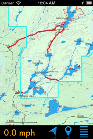
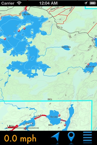
Experience a level of confidence like never before when paddling the Boundary Waters Canoe Area and Quetico with PaddleNav, the first detailed iOS map of the canoeists paradise, based on our very popular line of GPS maps. Most importantly, this map works offline, so no cell network access is required, a valuable feature in this remote wilderness area. Map features include:
•Hand edited and verified for accuracy
•Most detailed map data available
•Lakes, rivers, streams, elevation - no other GPS maps needed
•Depth lines on over 100 BWCA lakes
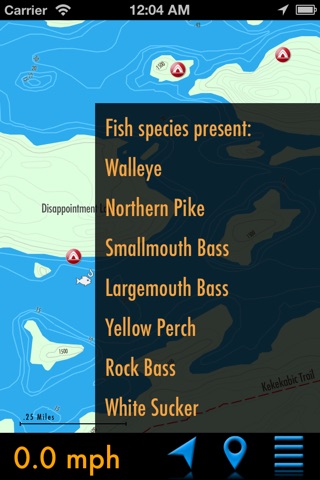
•Fish species info for hundreds of BWCA lakes
•BWCA campsites, portages, and entry points
•Quetico portages
•Portage lengths
•Thousands of geographic points of interest
•Hiking Trails - Old Pines, Kekekabik, etc.
Continued use of GPS running in the background can dramatically decrease battery life.